The following maps, referred to in various Elements, are hereby incorporated as an integral part of the Community General Plan. The maps are provided in PDF and JPEG file formats. PDF file sizes are from 200K-7MB and JPEG files from 100K-800K.
Map# |
Description |
File Type |
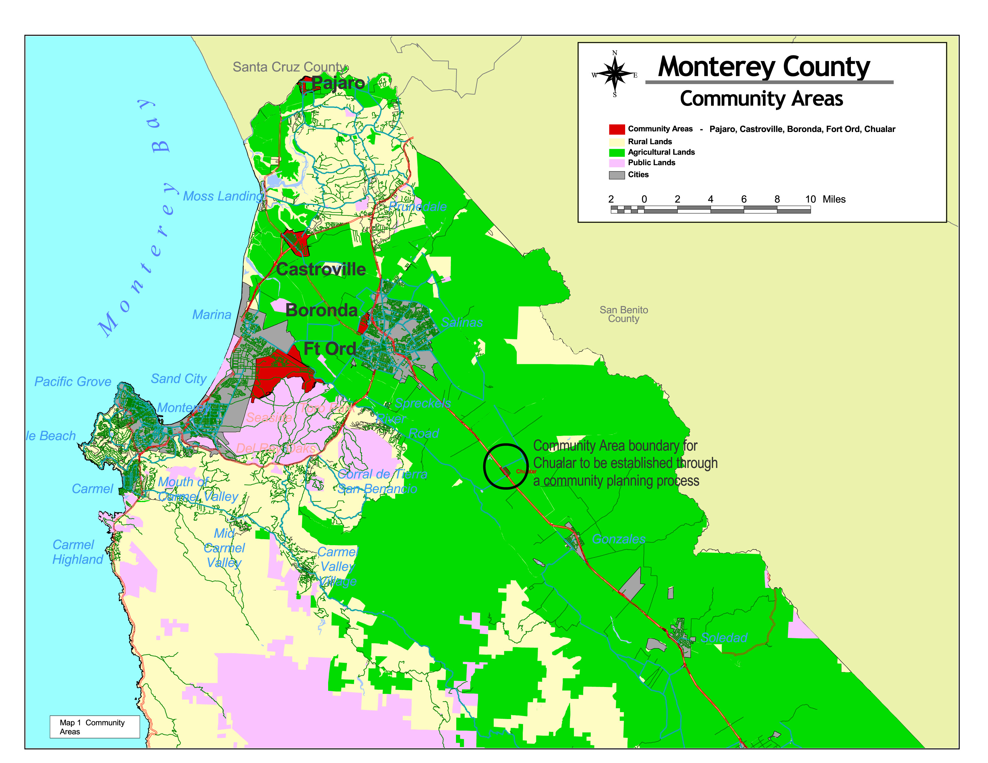
Map 1 |
Community Areas |
|
|
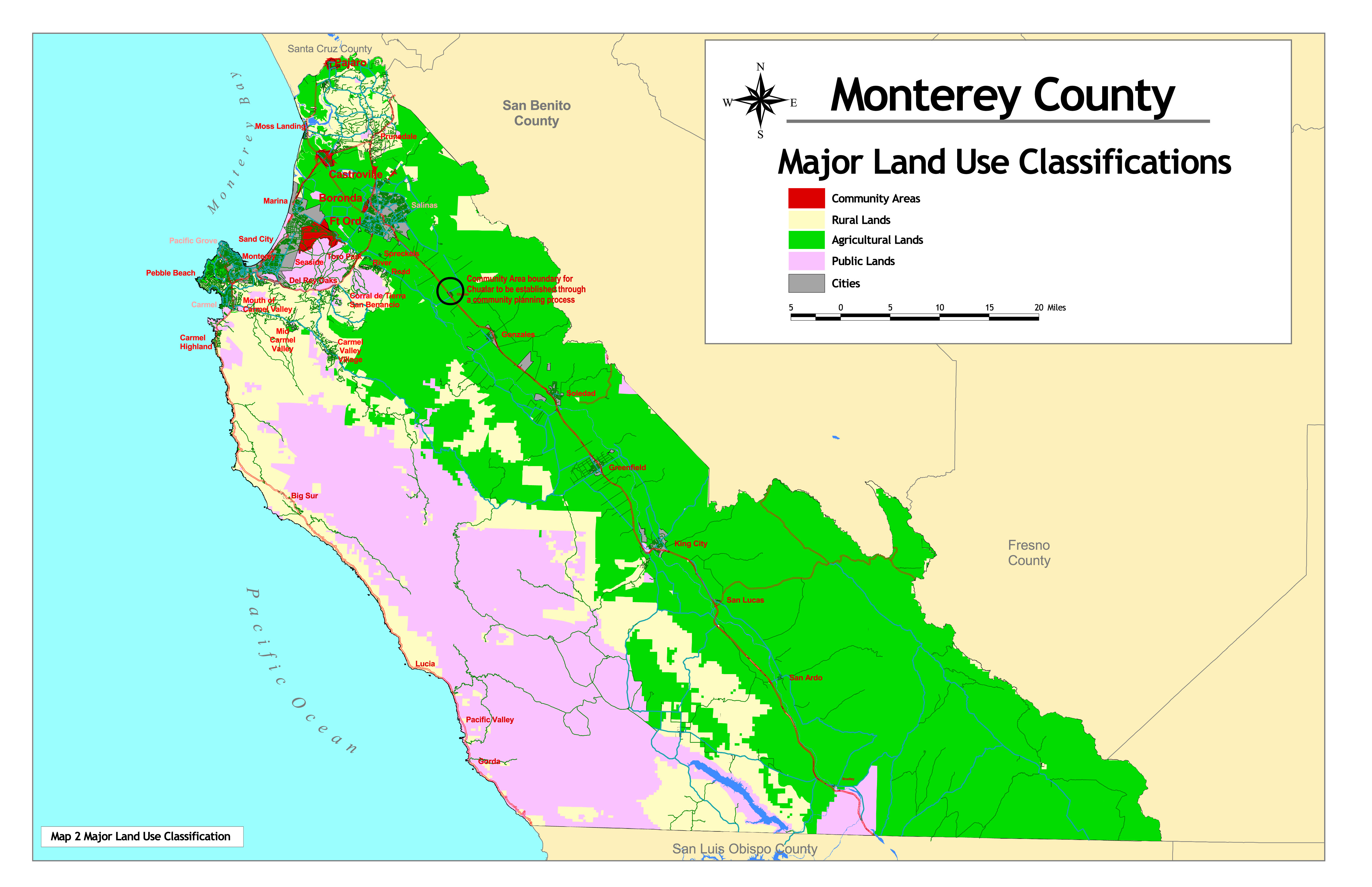
Map 2 |
Major Land Use Classifications |
|
|
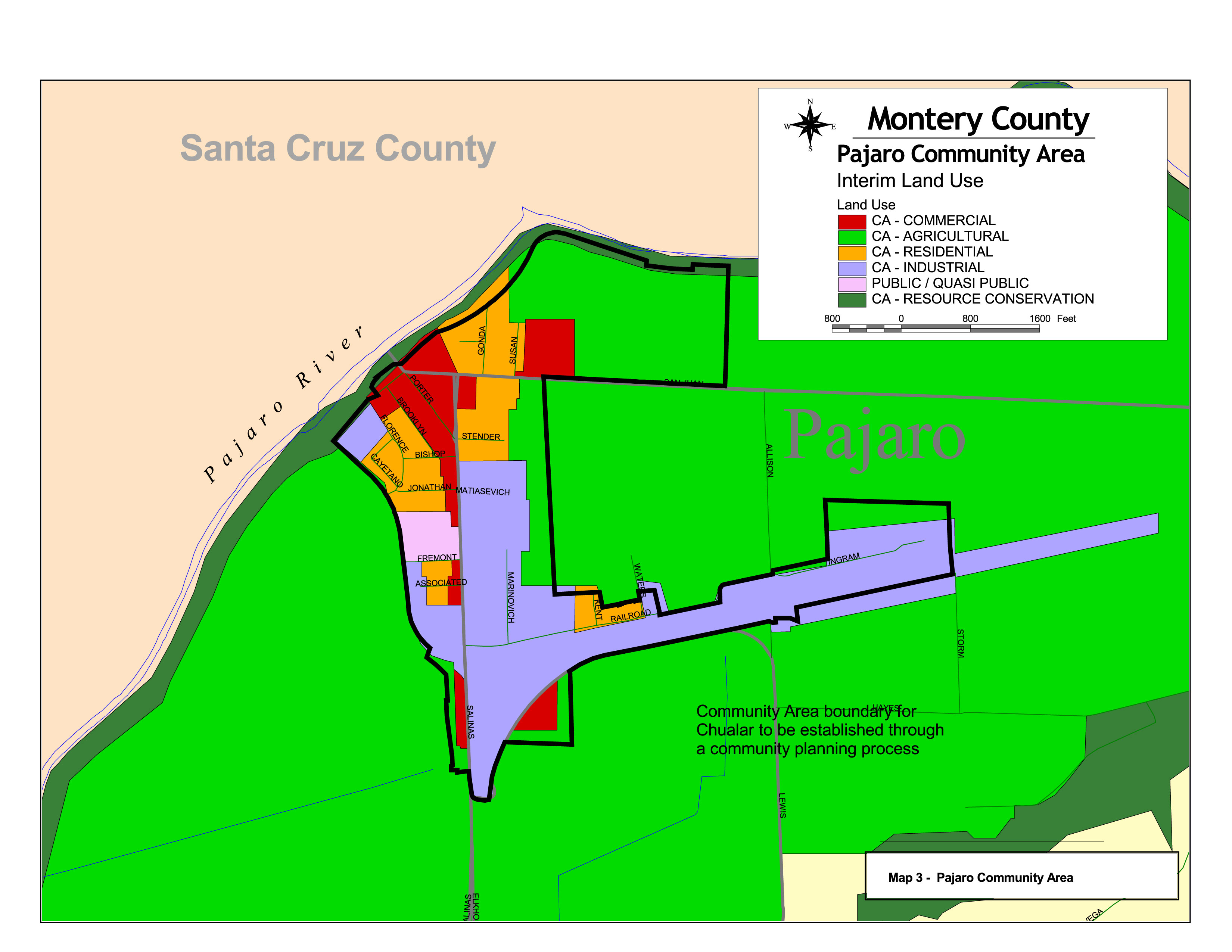
Map 3 |
Pajaro Community Area |
|
|
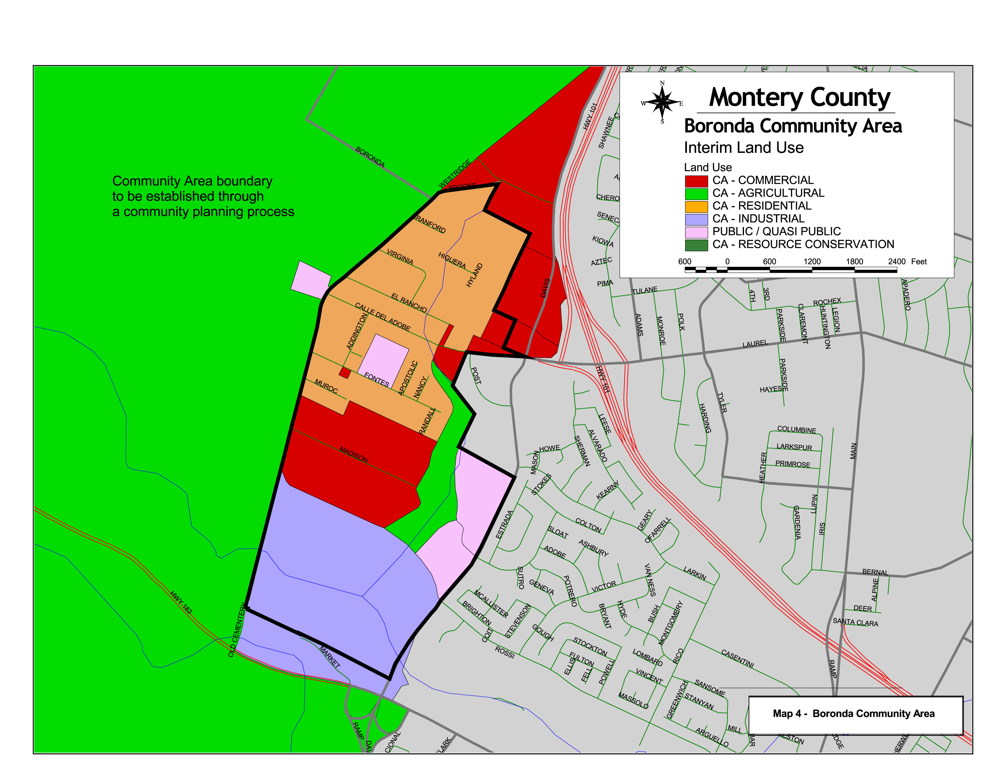
Map 4 |
Boronda Community Area |
|
|
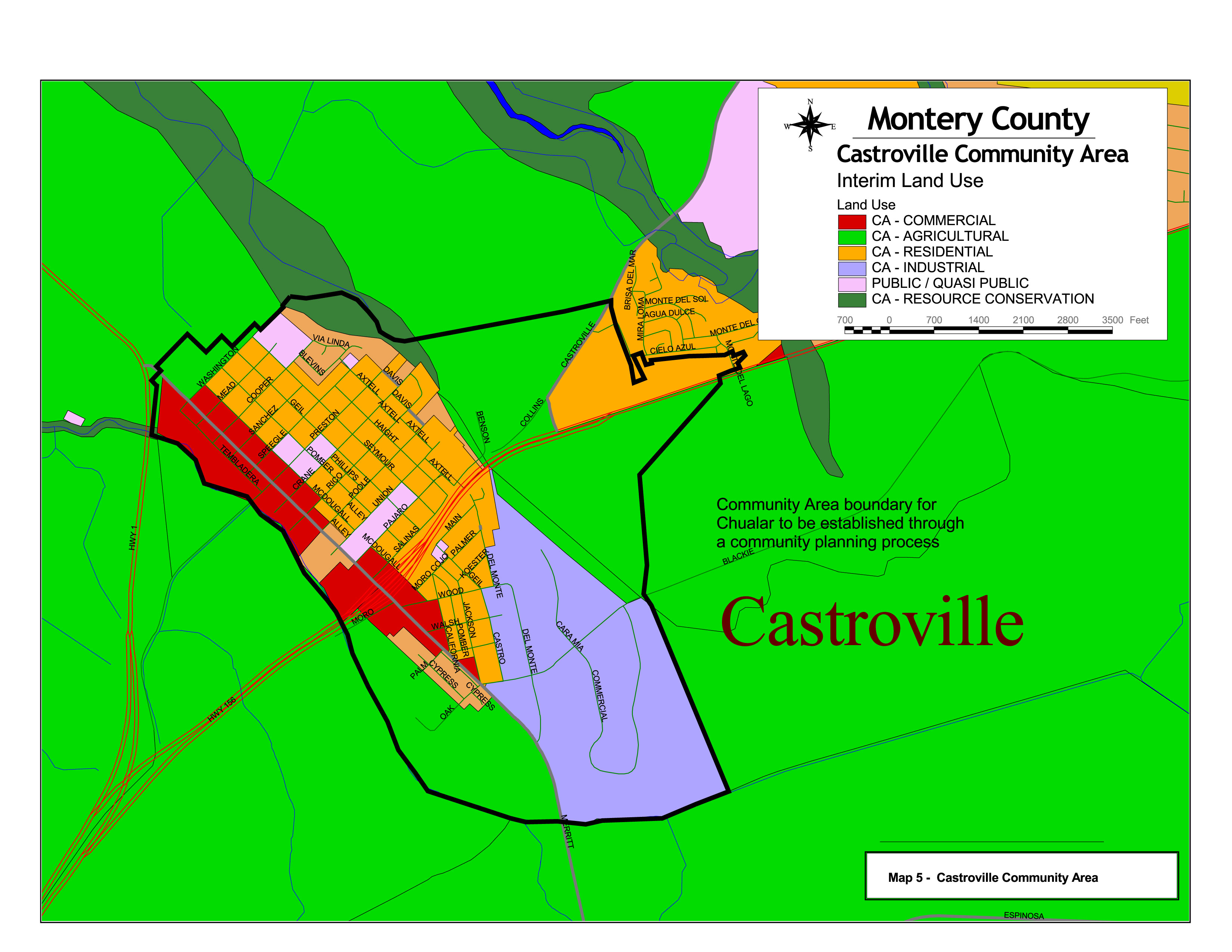
Map 5 |
Castroville Community Area |
|
|
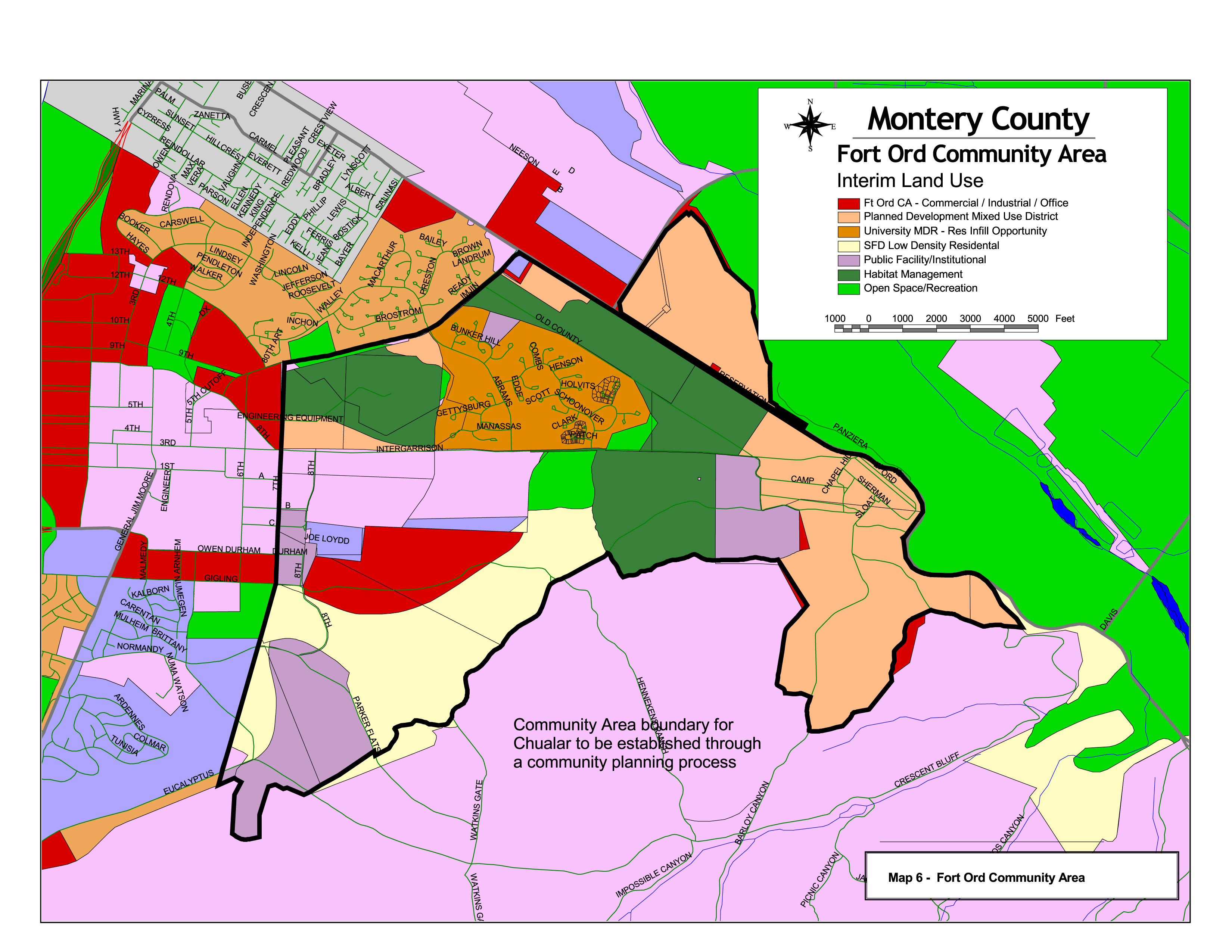
Map 6 |
Fort Ord Community Area |
|
|
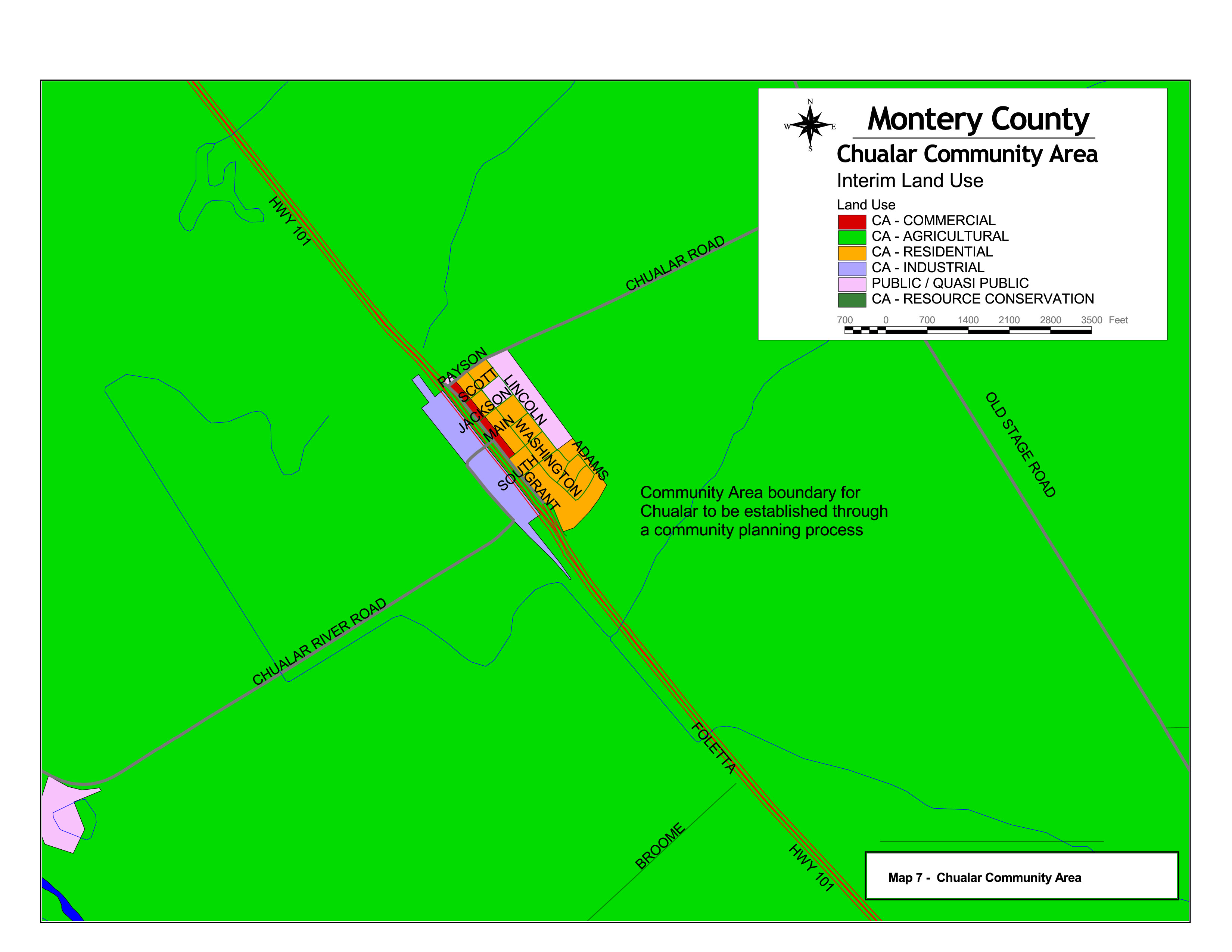
Map 7 |
Chualar Community Area |
|
|
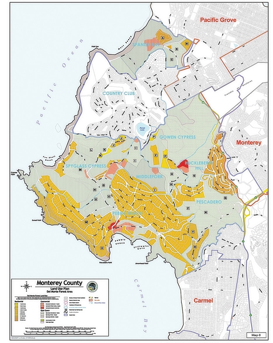
Map 8 |
Del Monte Forest Area |
|
|
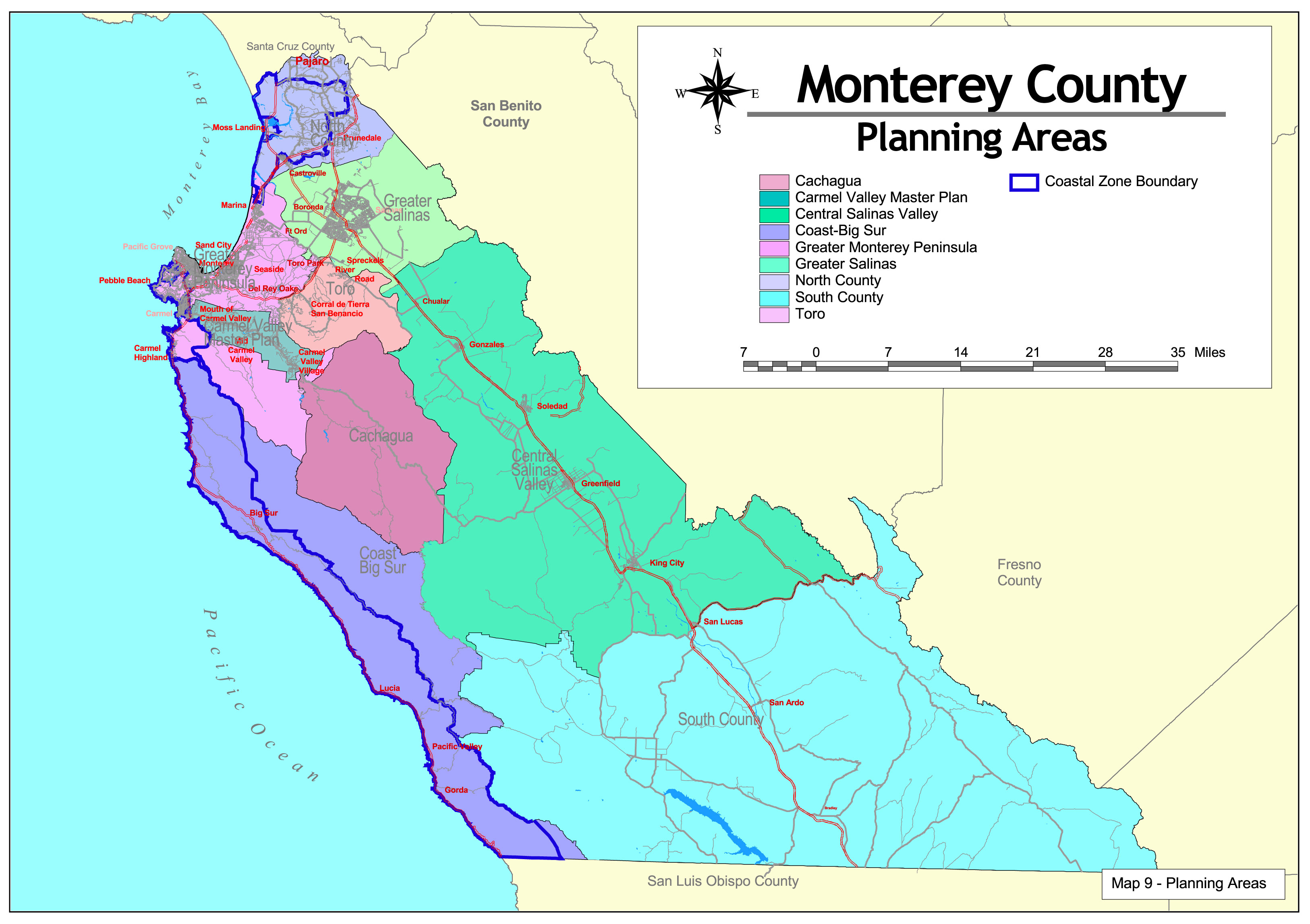
Map 9 |
Planning Areas |
|
|
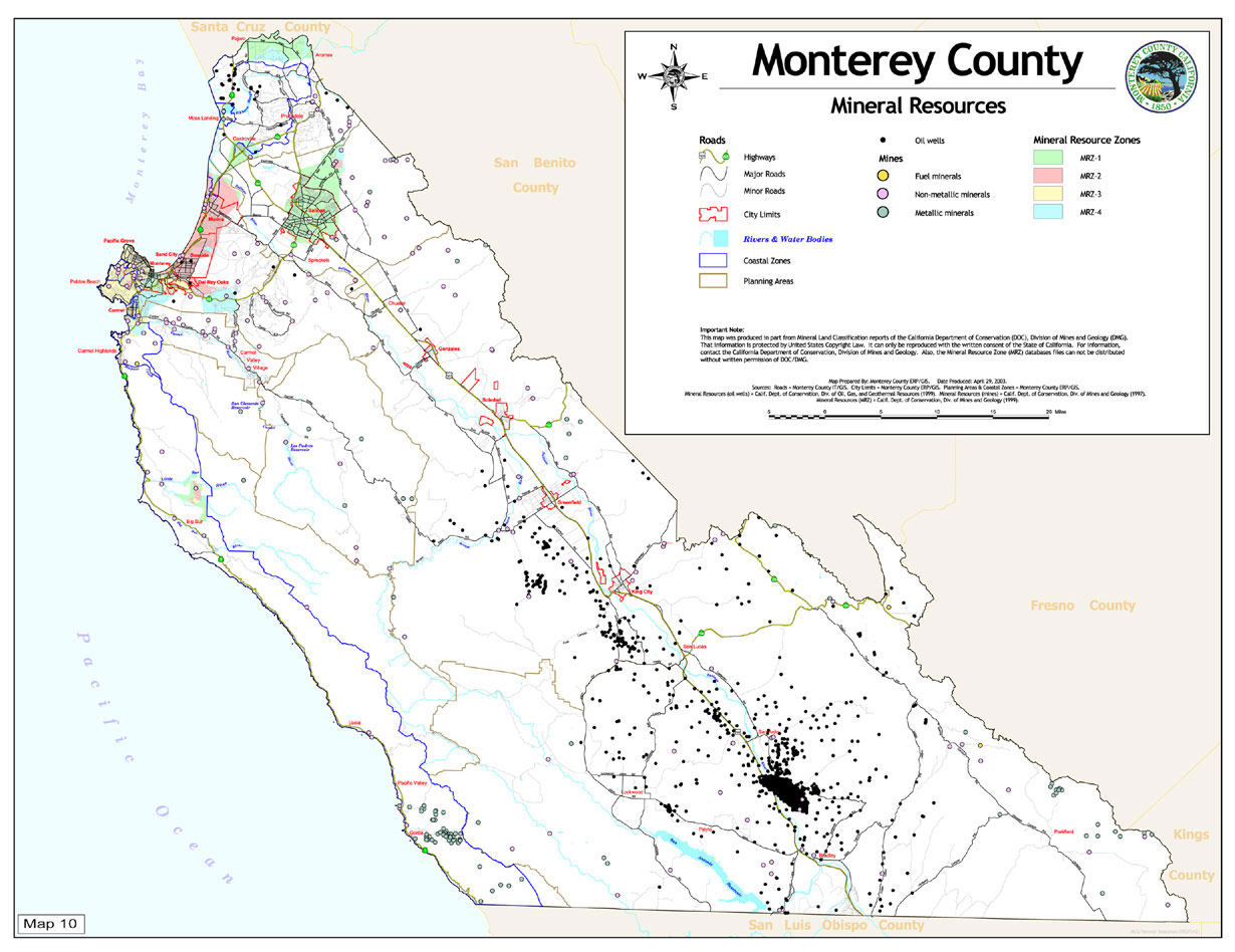
Map 10 |
Mineral Resources |
|
|
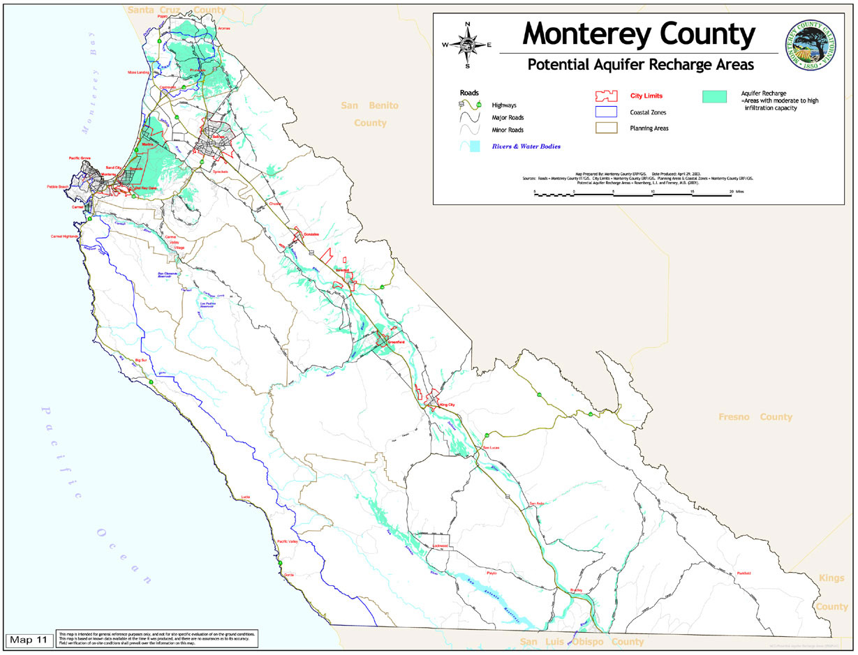
Map 11 |
Potential Aquifer Recharge Areas |
|
|
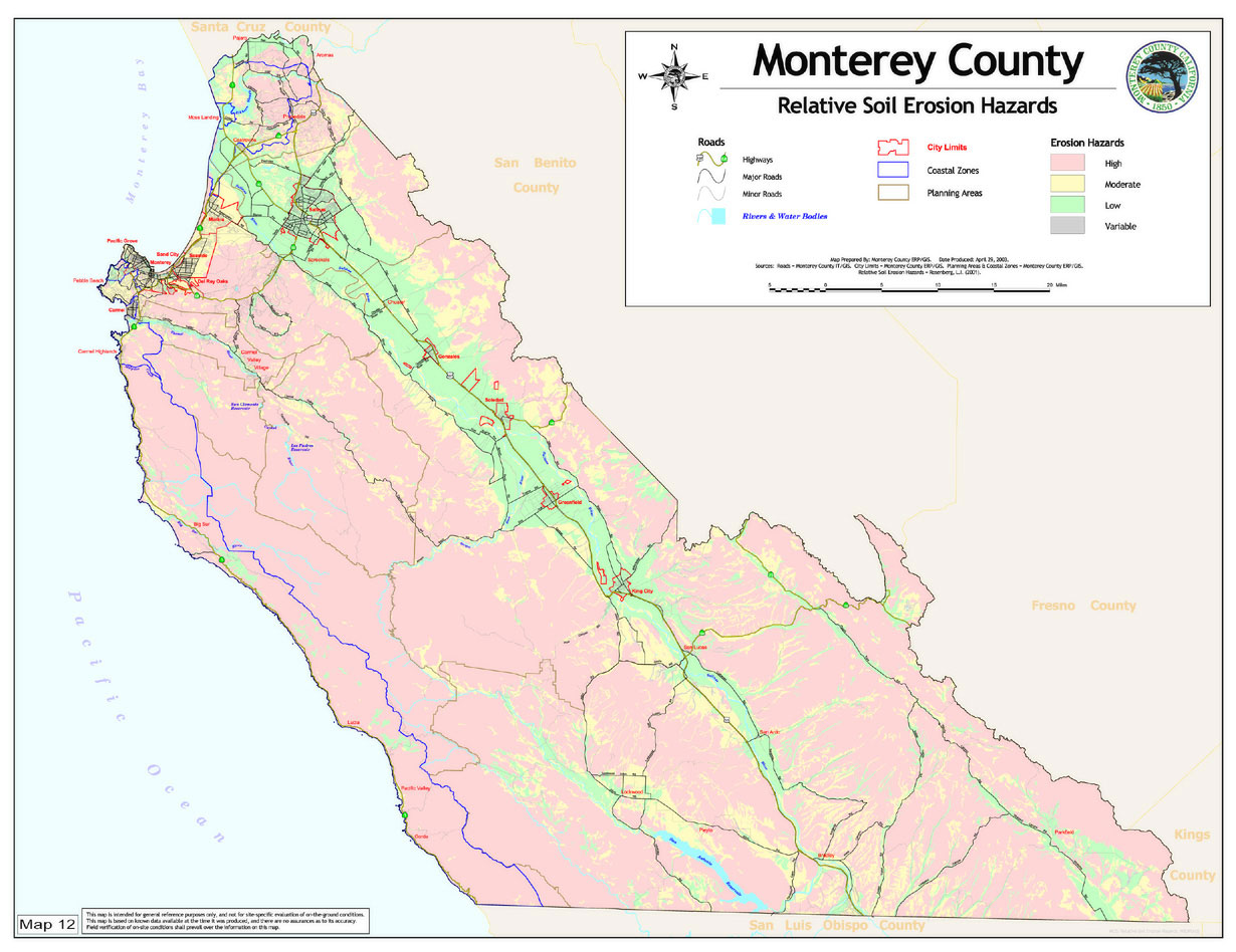
Map 12 |
Relative Soil Erosion Hazards |
|
|
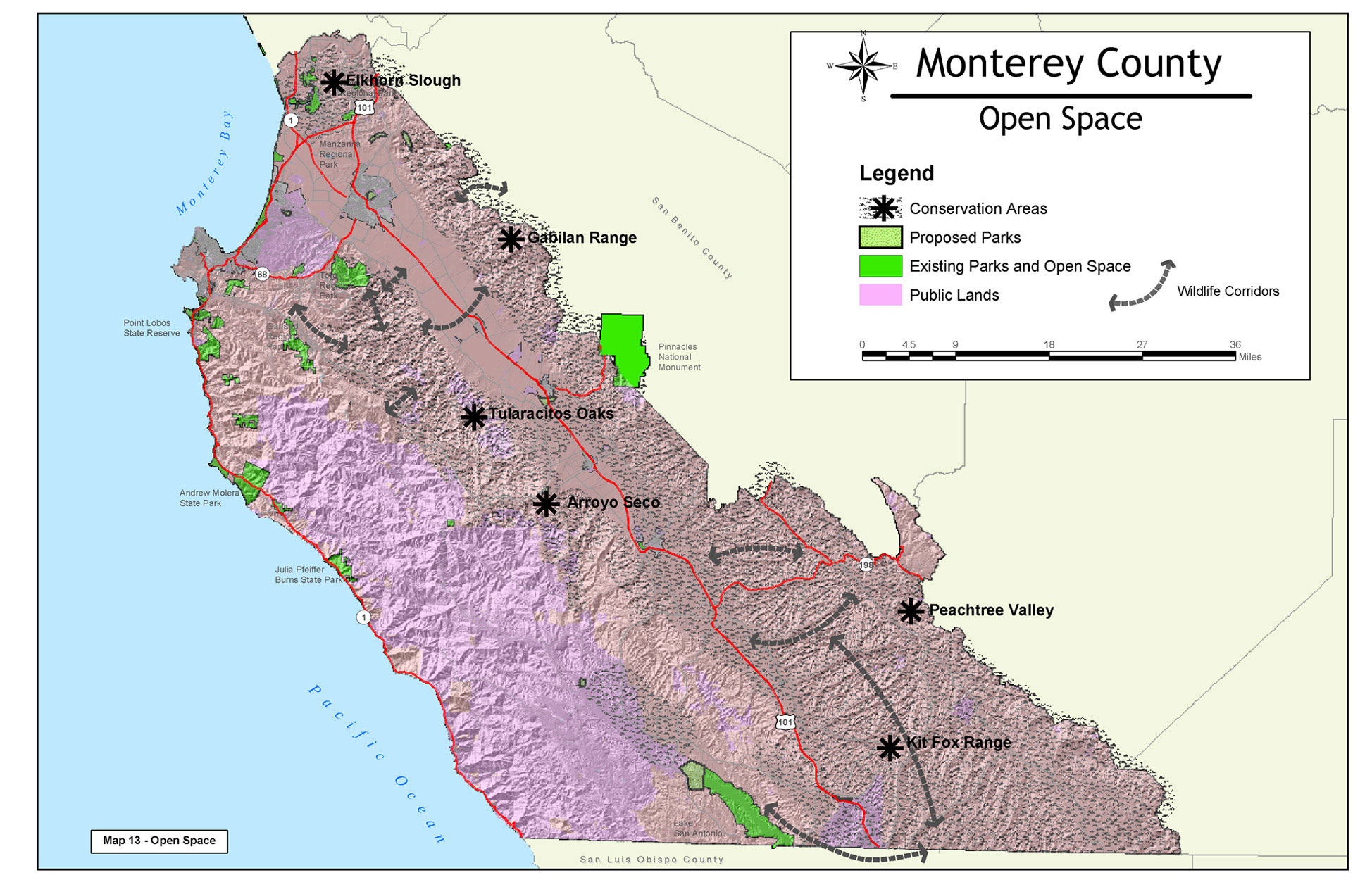
Map 13 |
Open Space |
|
|
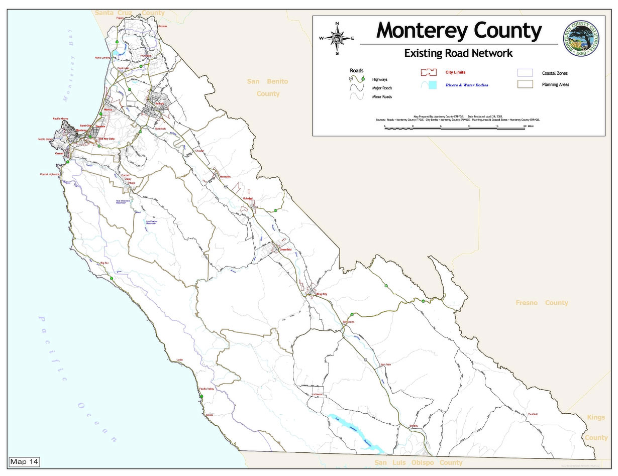
Map 14 |
Existing Road Network |
|
|
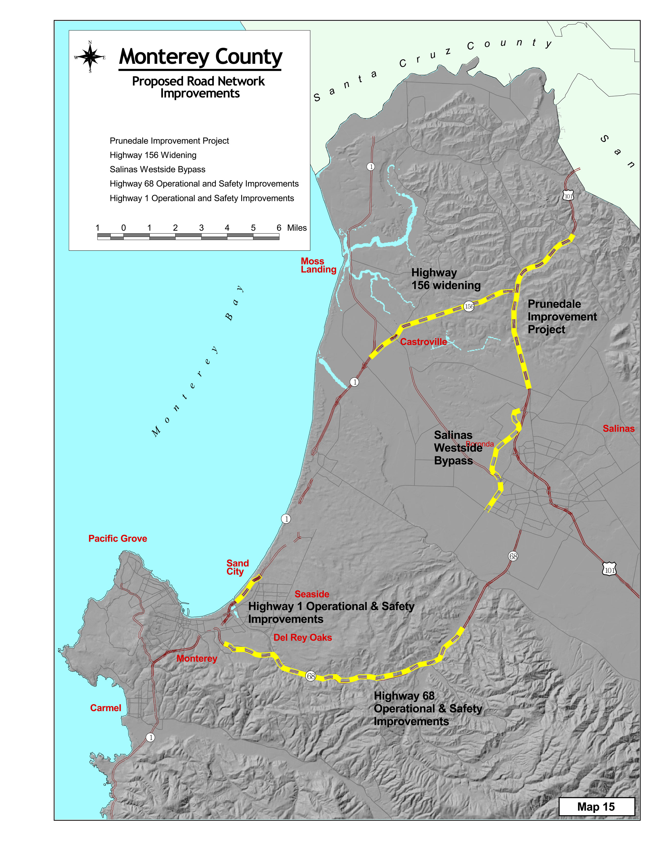
Map 15 |
Proposed Road Network |
|
|
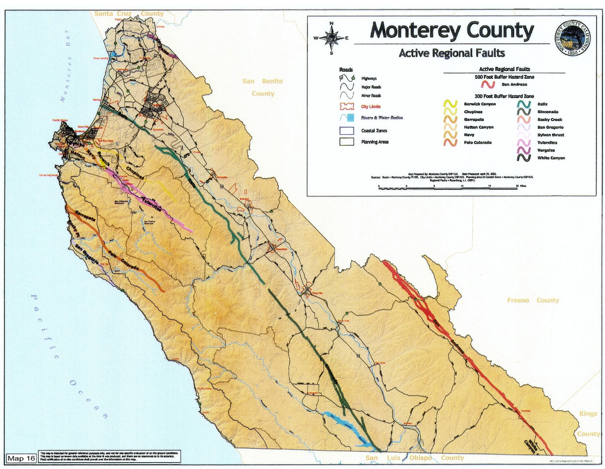
Map 16 |
Active Regional Faults |
|
|
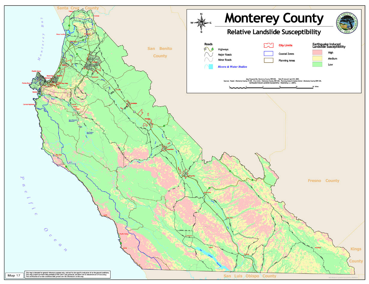
Map 17 |
Relative Landslide Susceptibility |
|
|
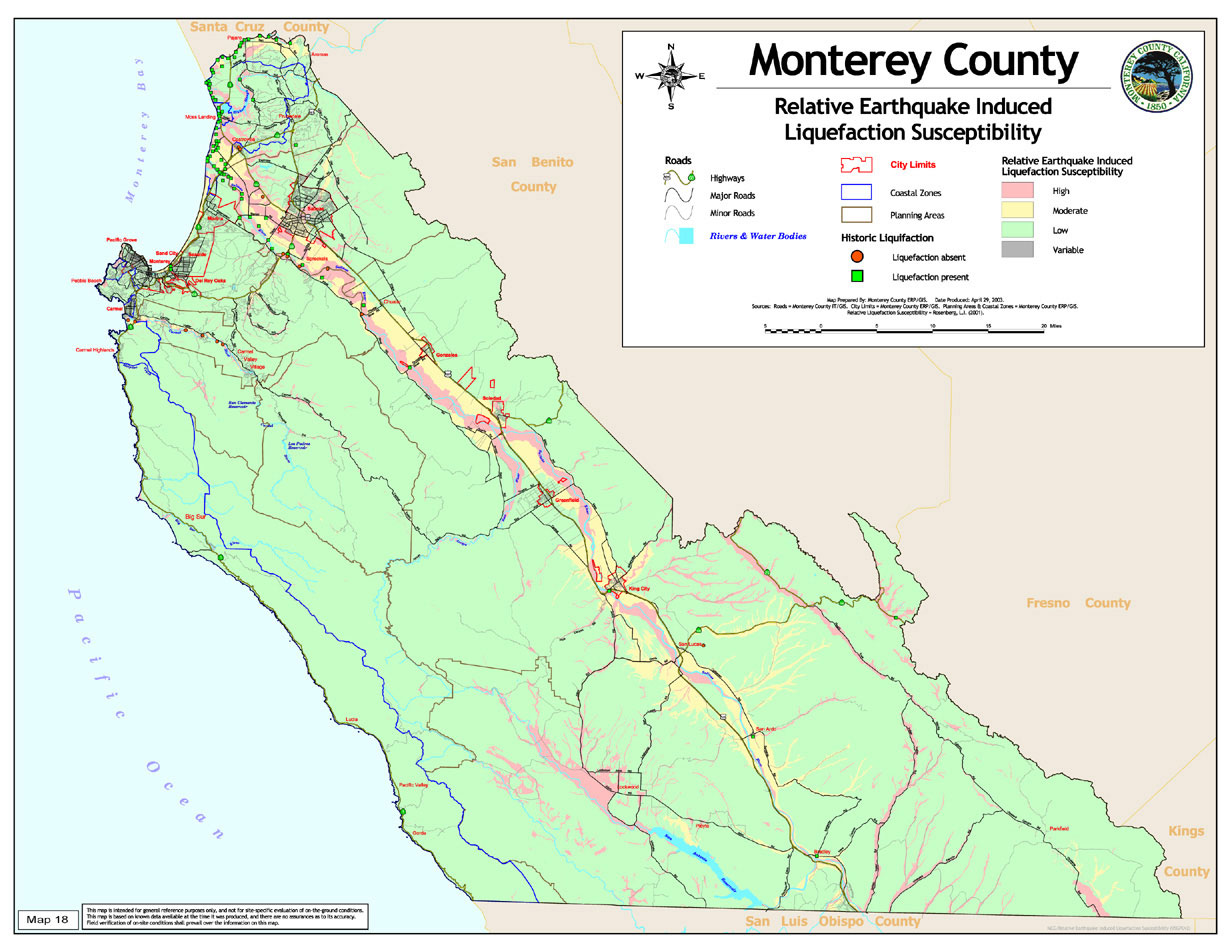
Map 18 |
Earthquake Induced Liquefaction Susceptibility |
|
|
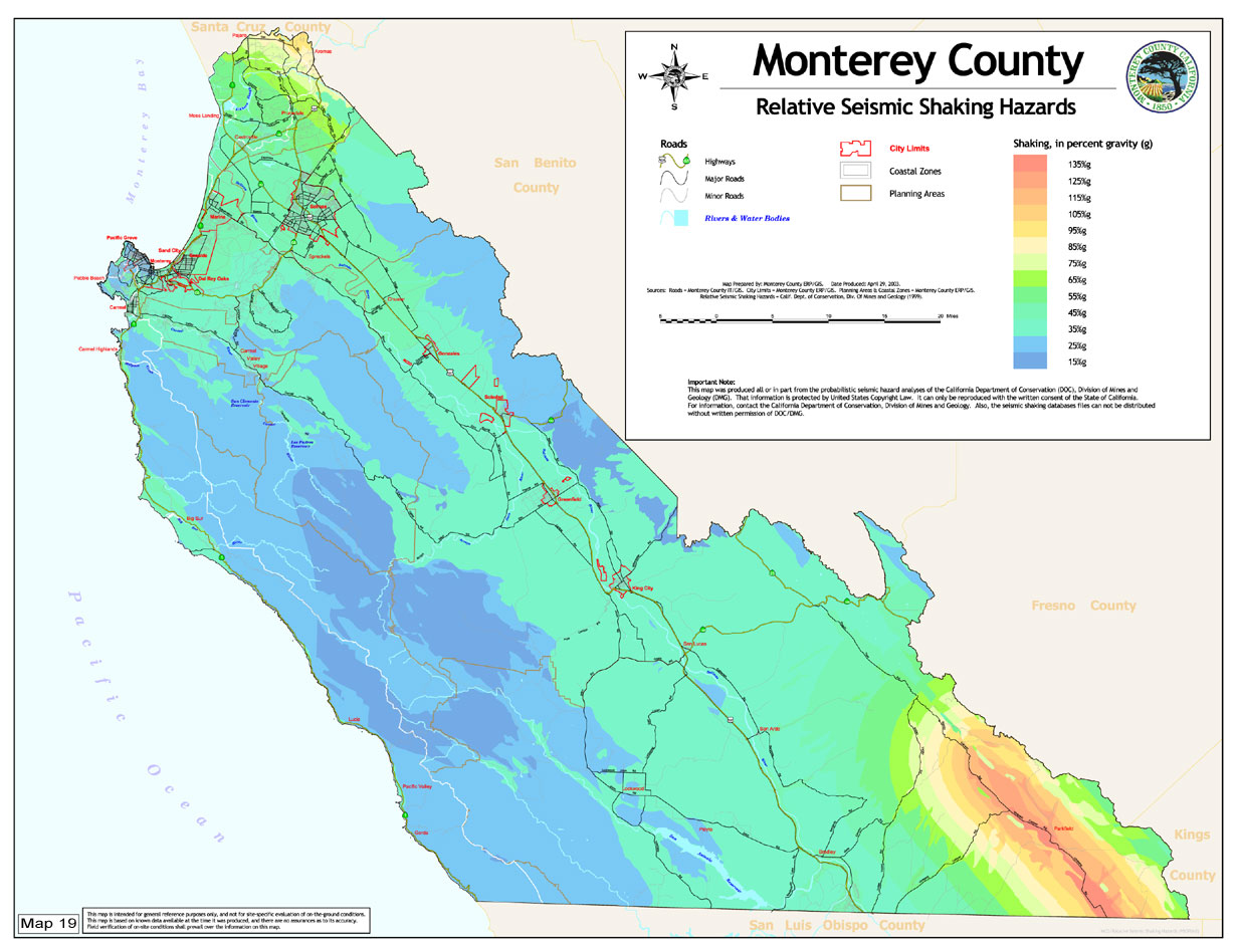
Map 19 |
Relative Seismic Shaking Hazards |
|
|
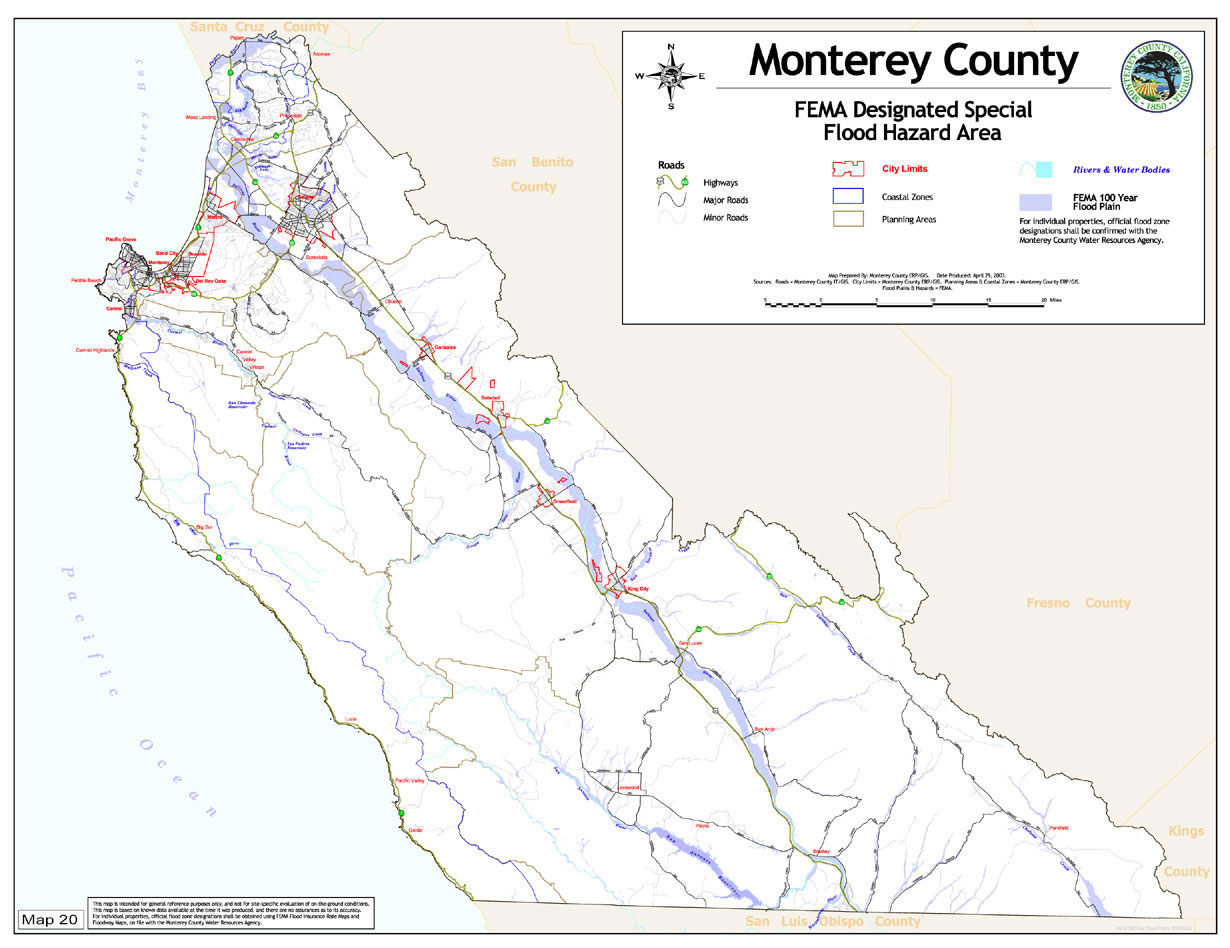
Map 20 |
FEMA Designated Special Flood Hazard Area |
|
|
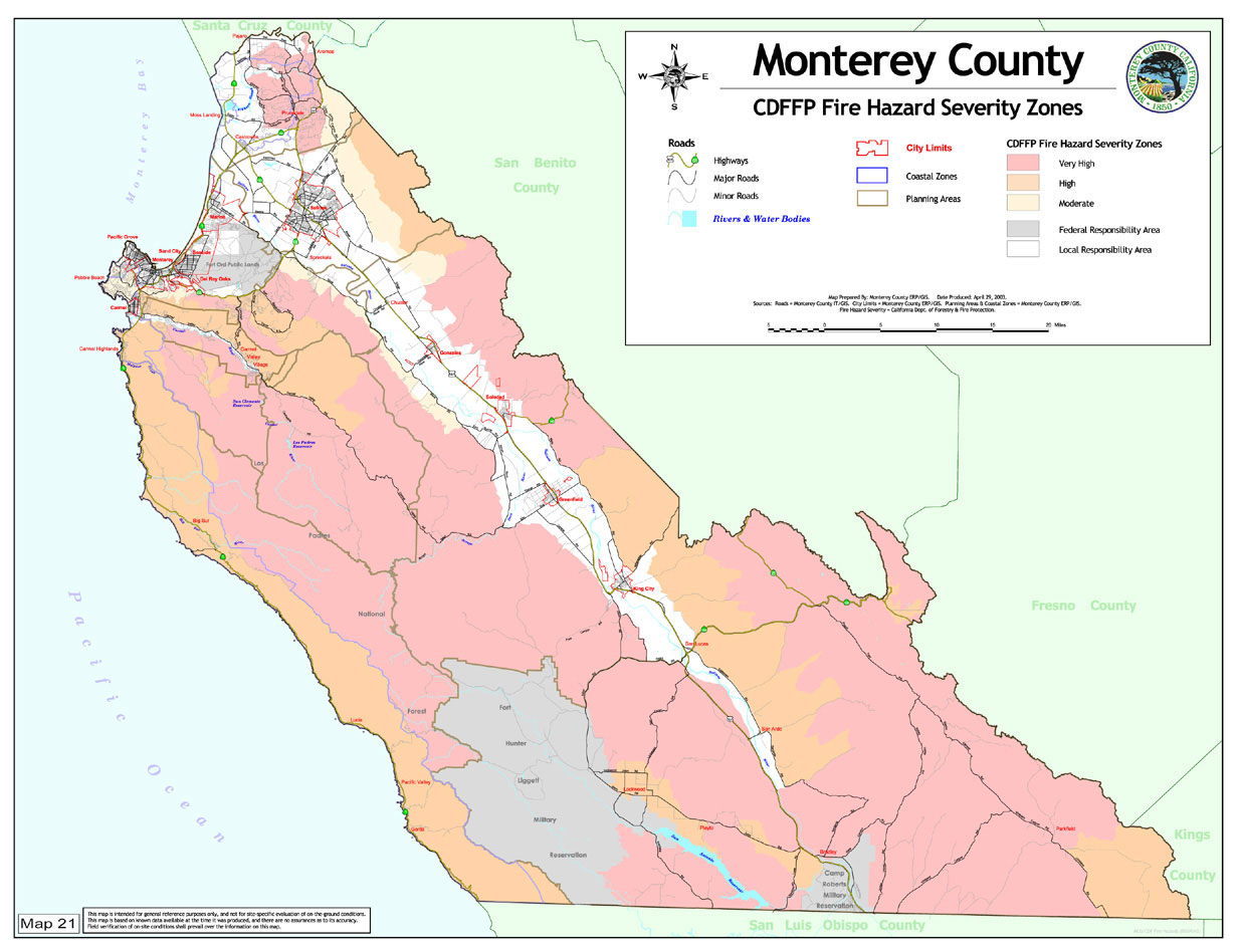
Map 21 |
CDFFP Fire Hazard Severity Zones |
|
|
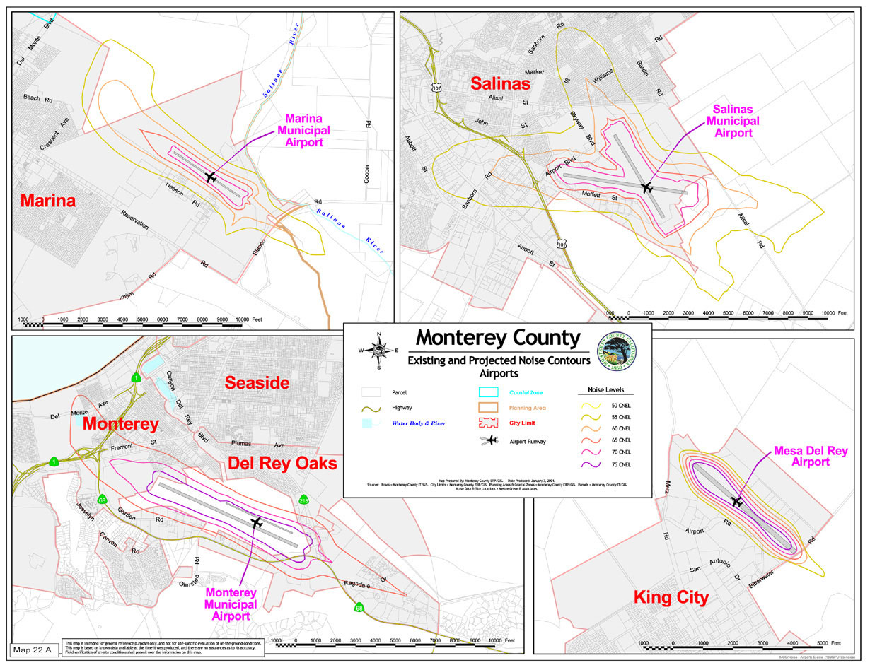
Map 22 A |
Existing and Projected Noise Contours (Airports) |
|
|
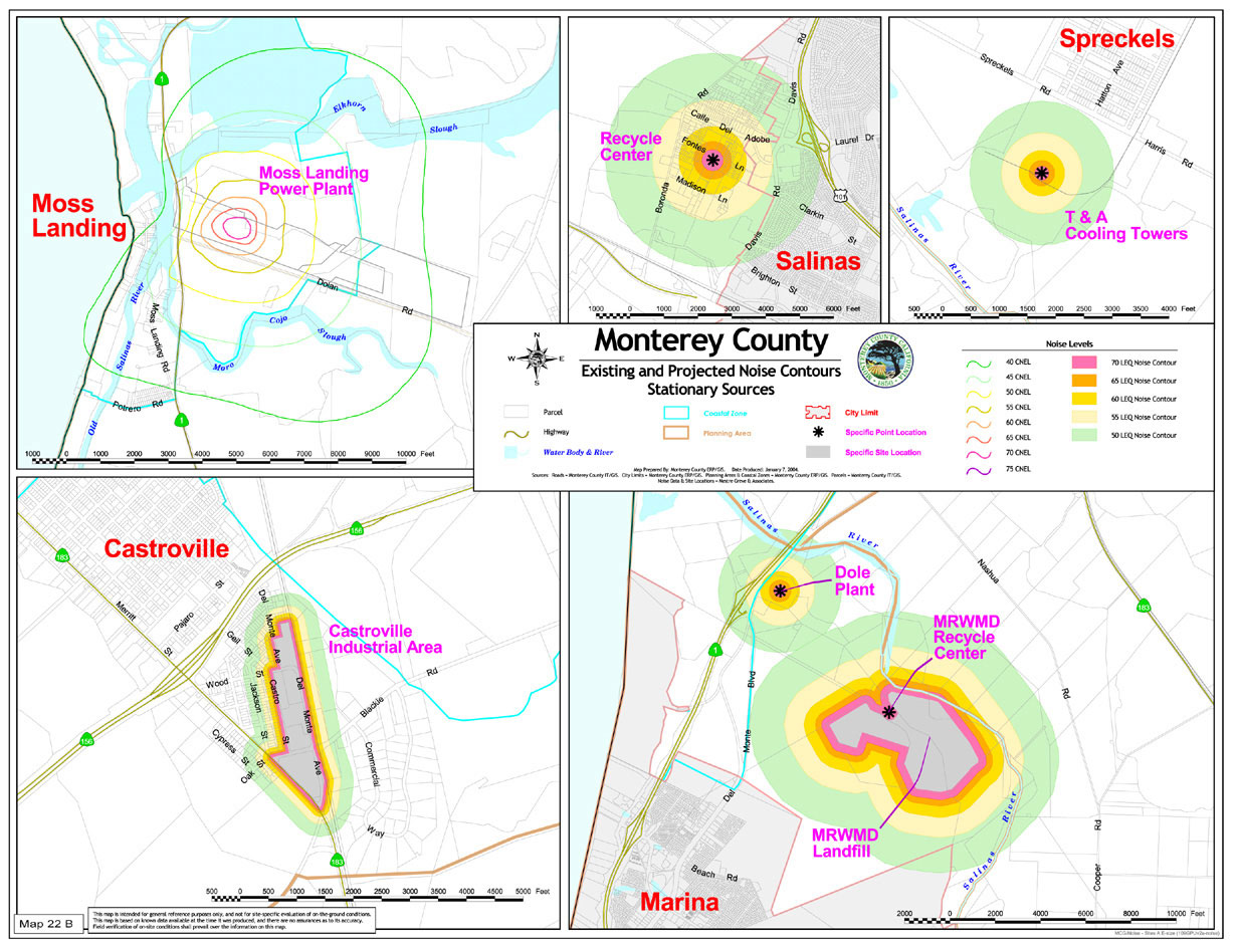
Map 22 B |
Existing and Projected Noise Contours (Stationary Sources) |
|
|
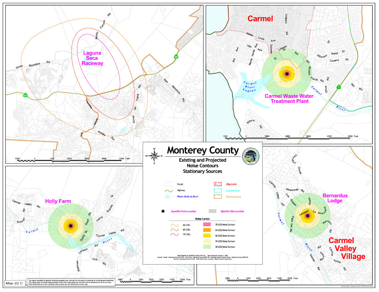
Map 22 C |
Existing and Projected Noise Contours (Stationary Sources) |
|
|
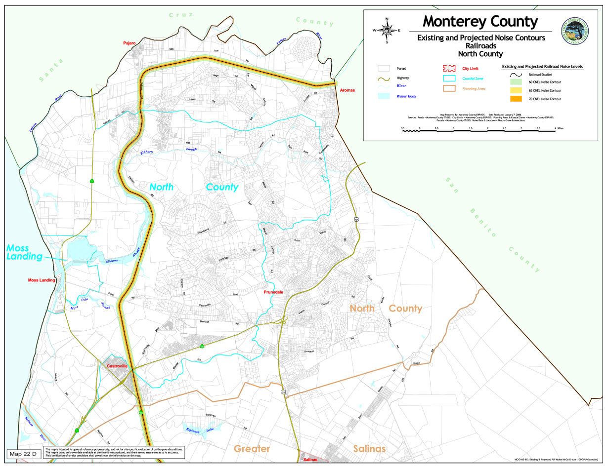
Map 22 D |
Existing and Projected Noise Contours (Railroads North County) |
|
|
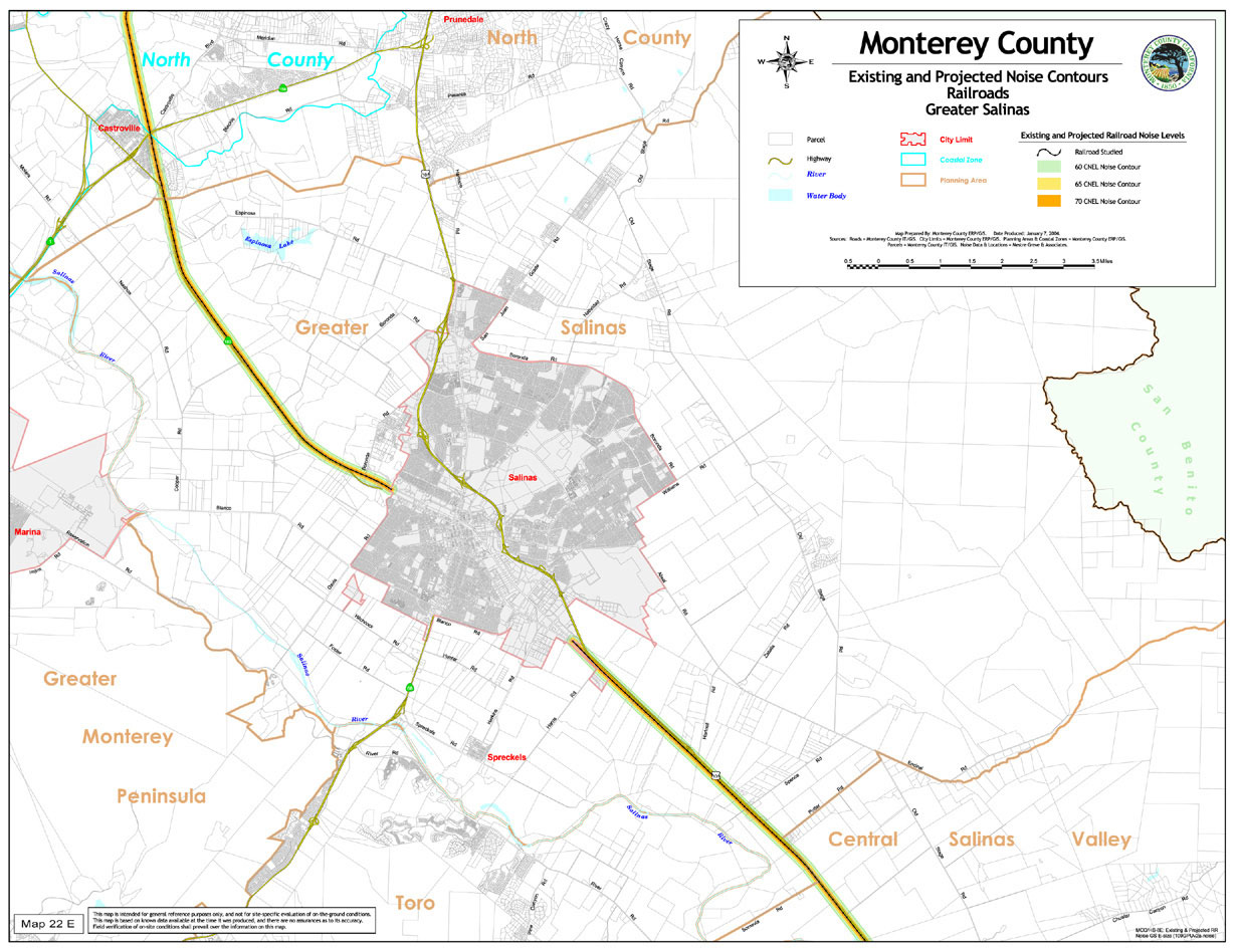
Map 22 E |
Existing and Projected Noise Contours (Railroads Greater Salinas) |
|
|
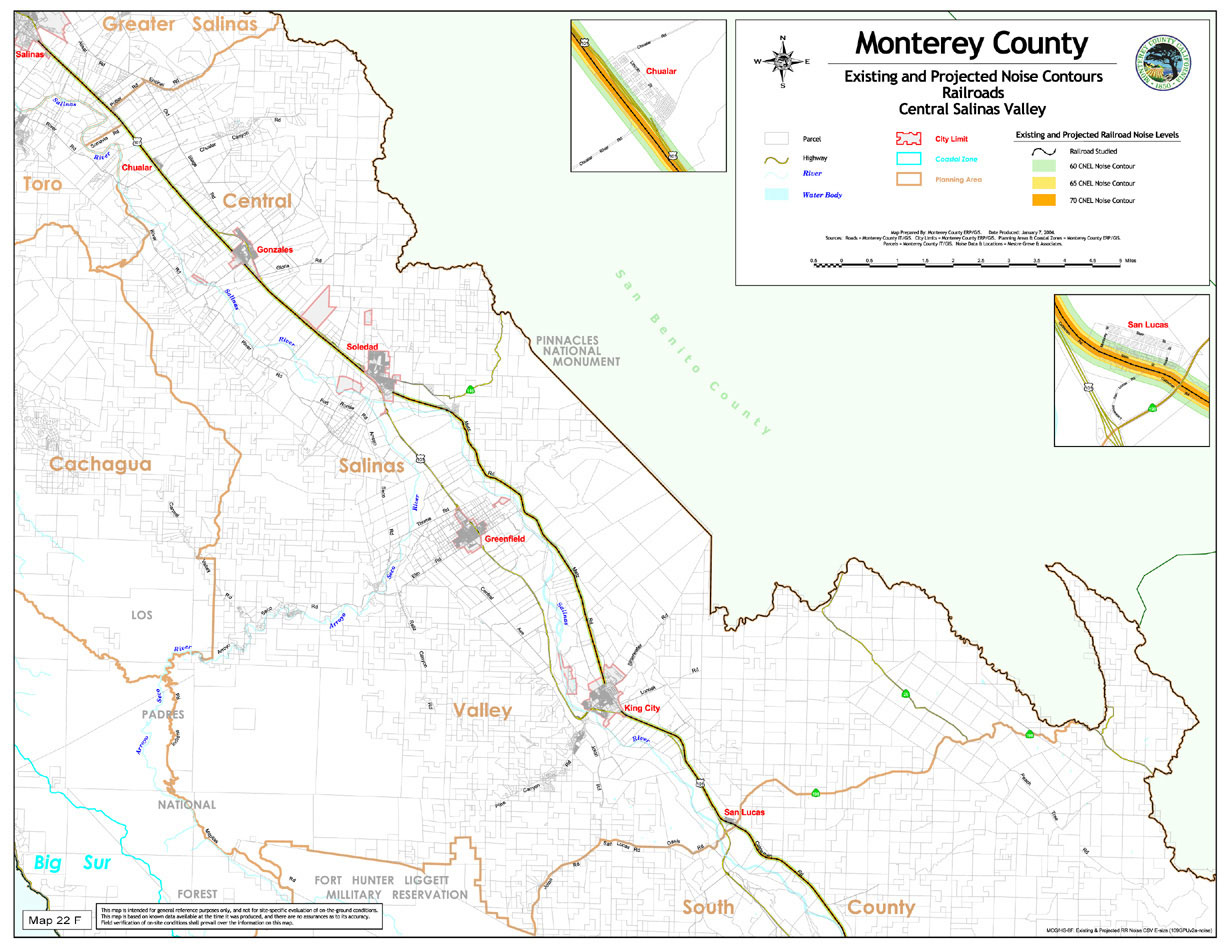
Map 22 F |
Existing and Projected Noise Contours (Railroads Central Salinas Valley) |
|
|
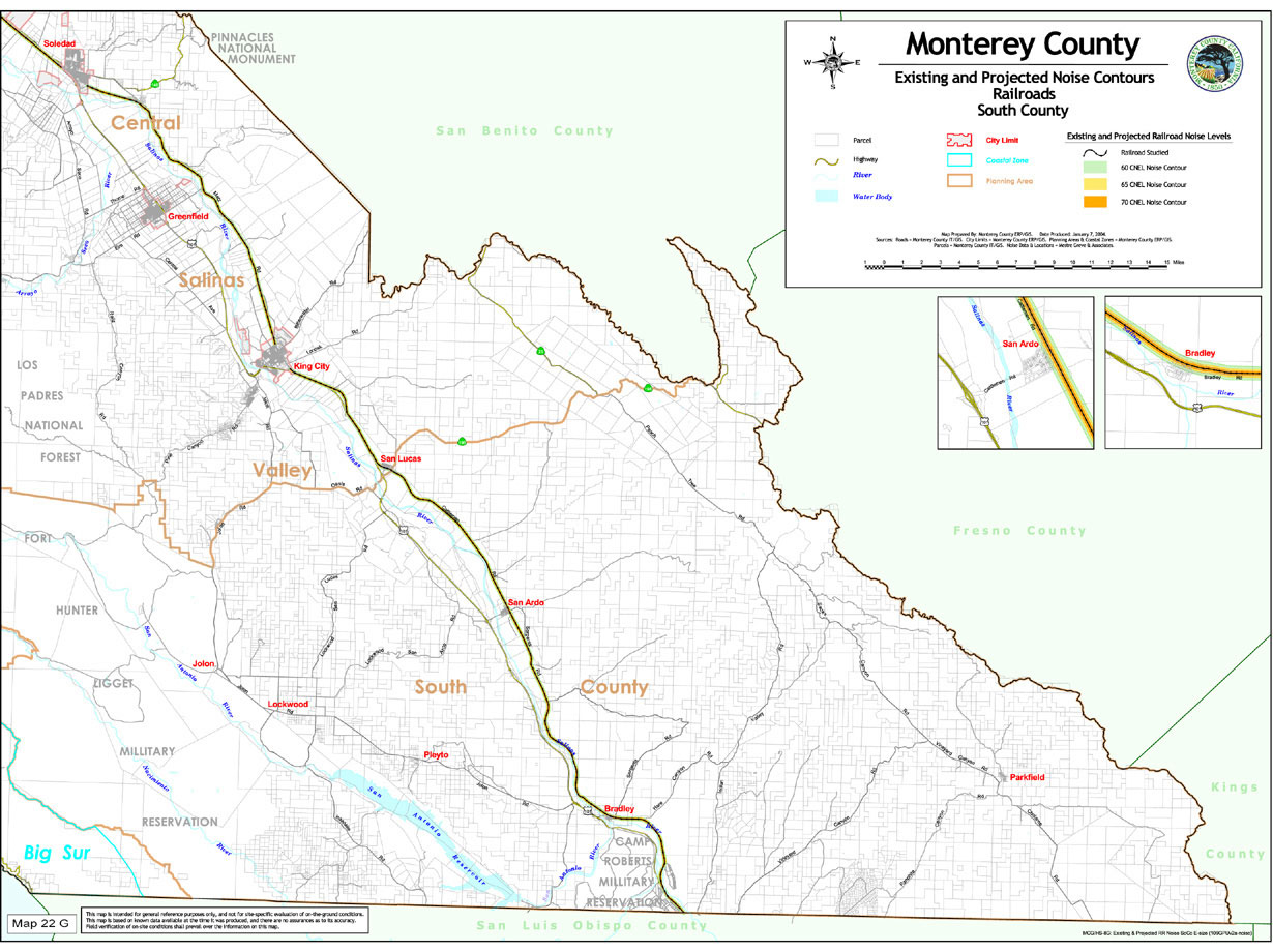
Map 22 G |
Existing and Projected Noise Contours (Railroads South County) |
|
|
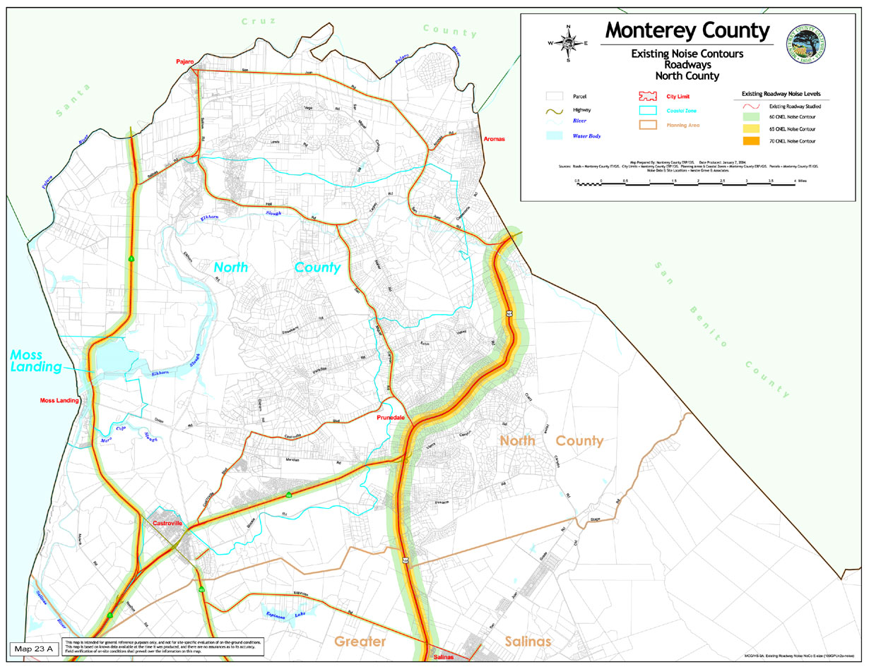
Map 23 A |
Existing Noise Contours (Roadways North County) |
|
|
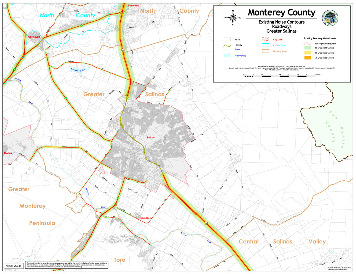
Map 23 B |
Existing Noise Contours (Roadways Greater Salinas) |
|
|
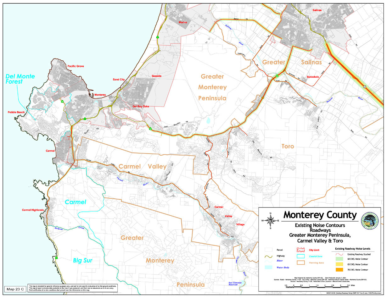
Map 23 C |
Existing Noise Contours (Roadways Greater Monterey Peninsula, Carmel Valley & Toro) |
|
|
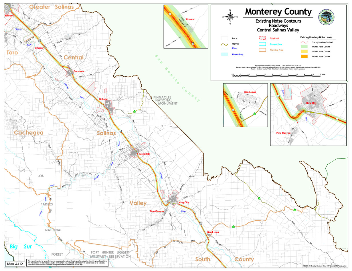
Map 23 D |
Existing Noise Contours (Roadways Central Salinas Valley) |
|
|
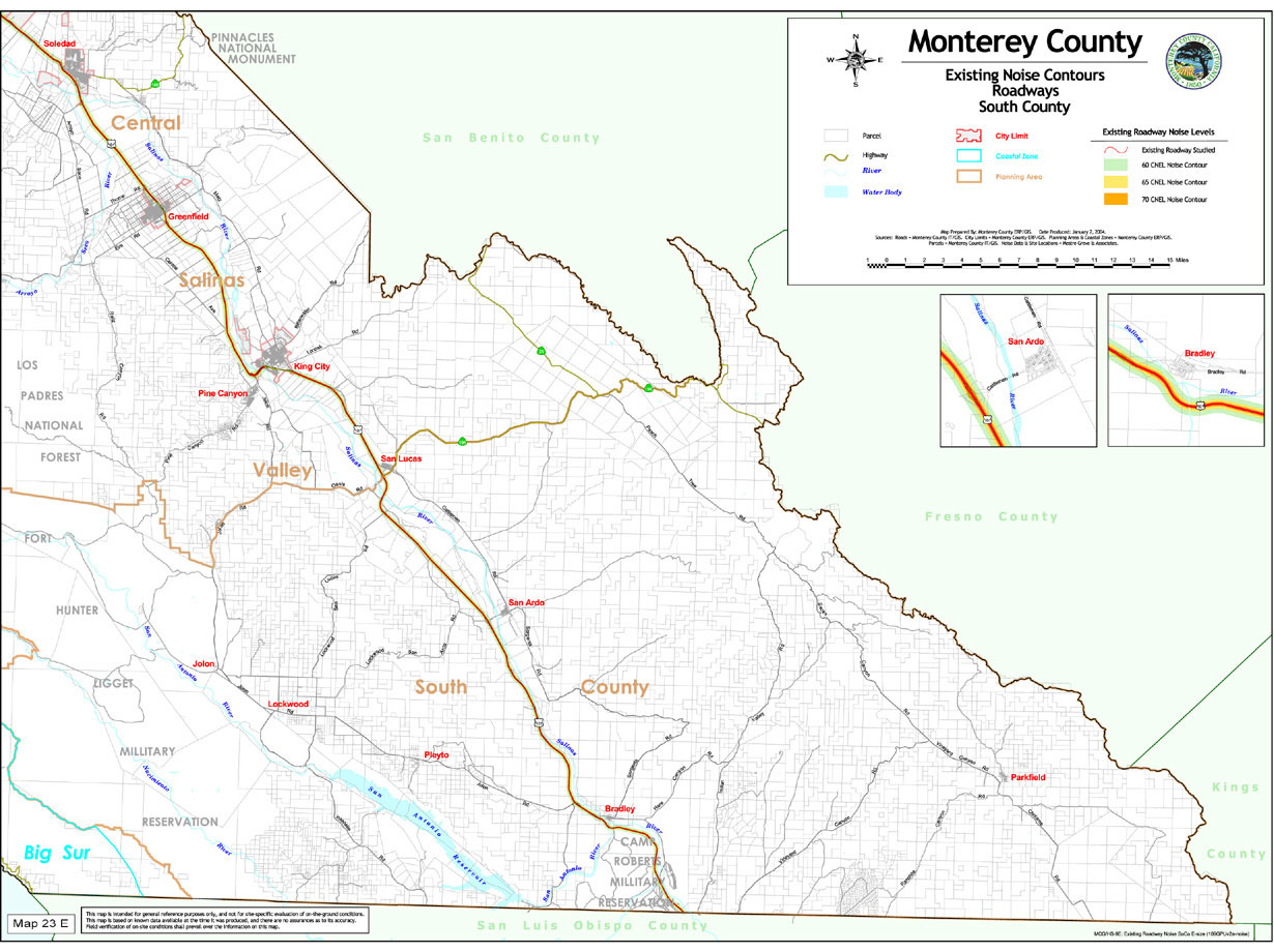
Map 23 E |
Existing Noise Contours (Roadways South County) |
|
|
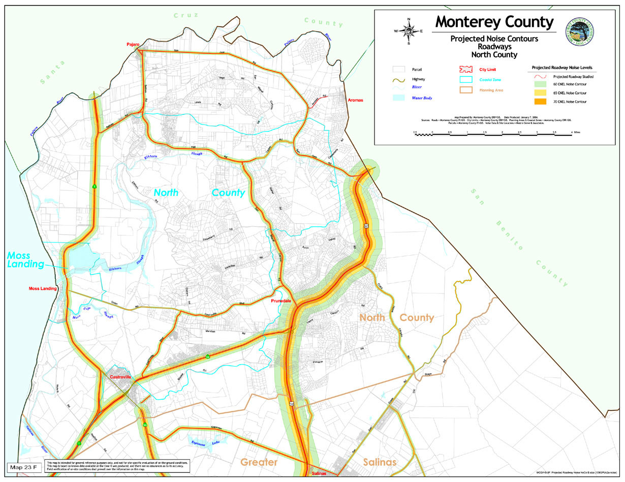
Map 23 F |
Projected Noise Contours (Roadways North County) |
|
|
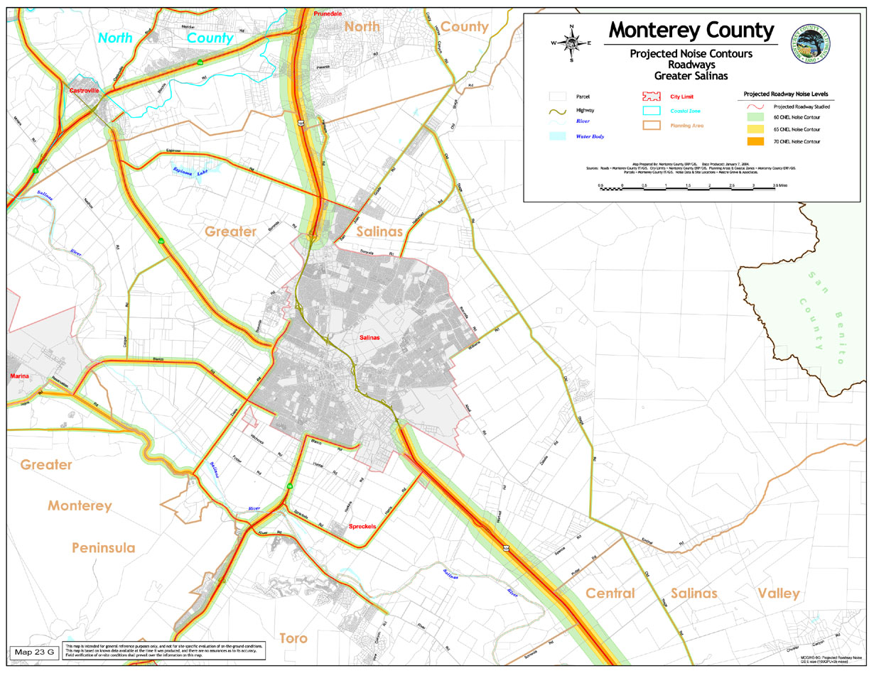
Map 23 G |
Projected Noise Contours (Roadways Greater Salinas) |
|
|
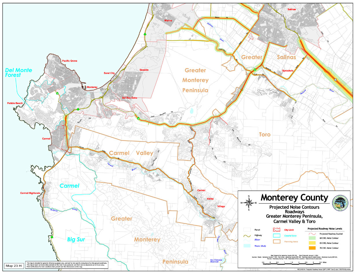
Map 23 H |
Projected Noise Contours (Roadways Greater Monterey Peninsula, Carmel Valley & Toro) |
|
|
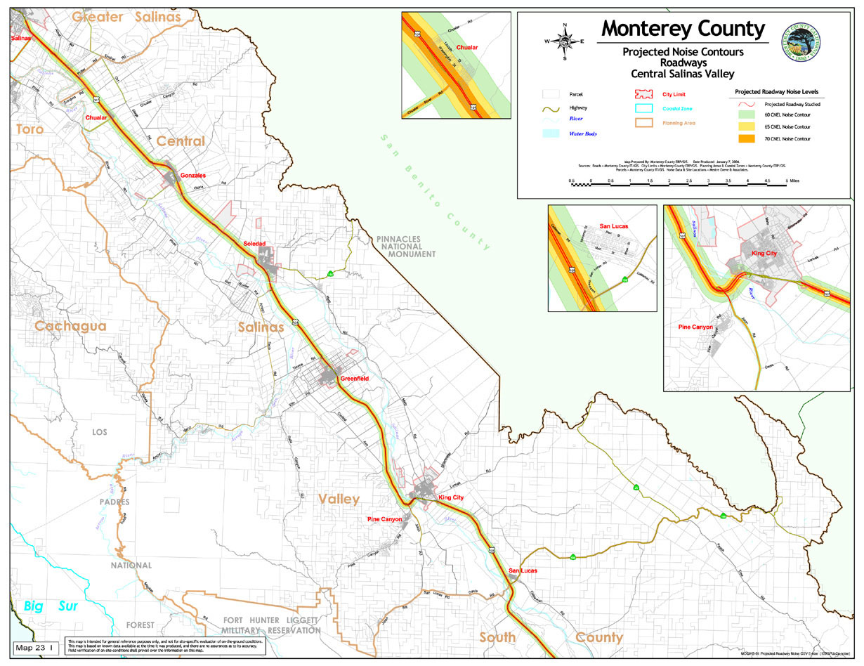
Map 23 I |
Projected Noise Contours (Roadways Central Salinas Valley) |
|
|
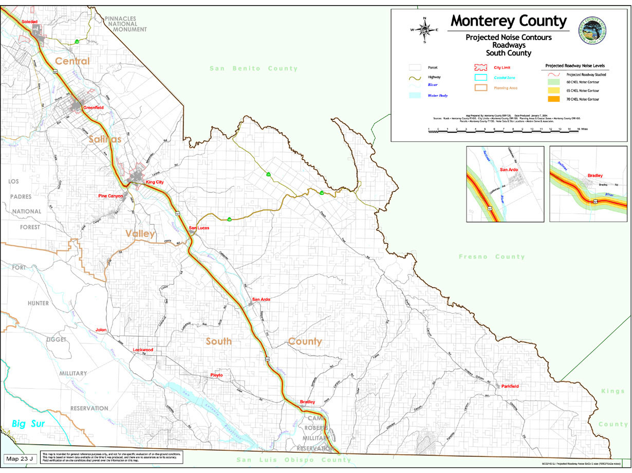
Map 23 J |
Projected Noise Contours (Roadways South County) |
|
|