| Home | Issues & Actions | About |
Archive Page This page is available as an archive to previous versions of LandWatch websites. |
Ferrini Ranch DEIR Comments Due November 16th
Domain Corporation, the developer of the Ferrini Ranch property, applied to develop its 870 acres located south of Highway 68 between River Road and San Benancio Road. The Ferrini Ranch project consists of 212 residential lots, a 35 acre winery, and four private roadway parcels. As proposed, the development requires the removal of 921 protected oak trees and building roadways to/within the development on steep hillsides (greater than 30%).
The Draft Environmental Impact Report (DEIR) has been released and comments are due by 5 PM to David Mack (MackD@co.monterey.ca.us) and the Clerk of the Board (cob@co.monterey.ca.us) in Monterey County. View the project’s DEIR on the County website.
The four biggest issues related to this project have to do with scenic resources (viewshed), traffic, biological resources, and water.
- Viewshed. Many of the proposed parcels are in the critical viewshed. The Toro Area Plan (specifically policy 40.2.5) requires building sites to be outside the critical viewshed, but the DEIR appears to permit them to be within this area as long as they are not visible from scenic roadways. That is not the intention of Toro Area Plan Policies.
- Traffic. The DEIR does not adequately analyze the traffic impacts. The DEIR assumes that a number of roadway improvements will be in place by the time the project is built, but fails to demonstrate that they are actually adopted and funded projects. Under California law payment of impact fees is adequate mitigation only if the fees go toward necessary improvements that are actually part of an adopted, funded impact fee program.
- Biological Resources. There are numerous concerns as it relates to biological resources including: (1) extensive revisions to the project’s layout are proposed (“as feasible”) to address impacts to species and habitat, including wetlands and waters of the US, but the EIR does not tell us where the lots will be; (2) feasibility of avoiding these impacts must be determined now or else we can expect the applicant will argue that mitigation is infeasible and will just offer off-site compensation; (3) no mitigation is proposed for permanent loss of grassland habitat for badgers or habitat for roosting bats; (4) oak woodland and wildlife corridors impact analysis and mitigation is inadequate; and (5) hazards, like wildfire, are not fully evaluated.
- Water. The DEIR assumes that there will be adequate water based on the project being in Zone 2C and it does not disclose litigation by LandWatch and TOMP challenging the premise that being in Zone 2C ensures adequate water. The DEIR provides no information about cumulative demand and sustainable yield for the Salinas Valley Groundwater basin and provides inadequate information about baseline conditions for the SV Groundwater Basin.
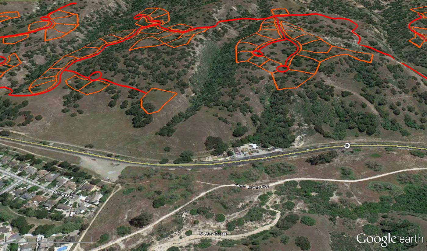
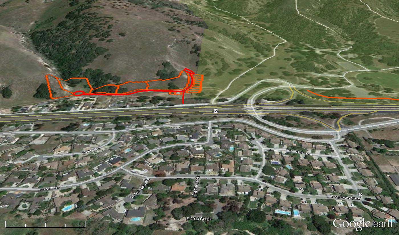
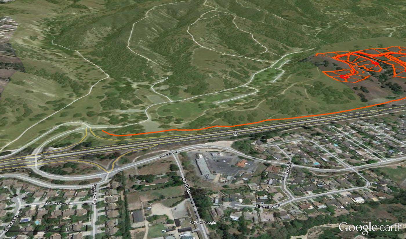
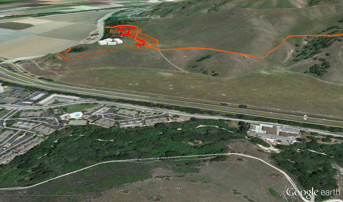
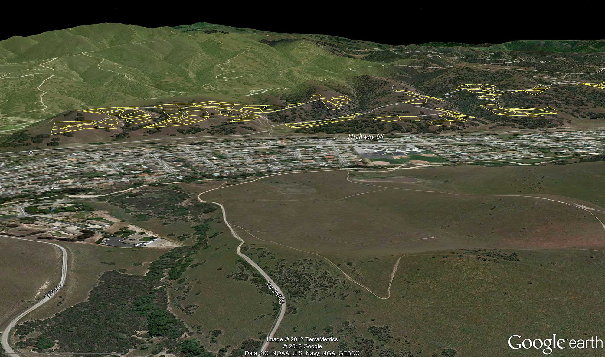
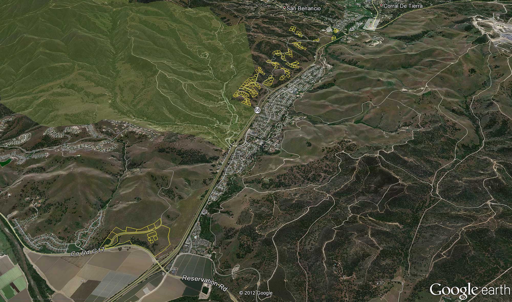
The following images represent aerial views of the property, using Google Earth, showing Ferrini Ranch’s relationship to existing communities, roads, parks, and the general area. The yellow lines represent the development lots within the project boundary and the green area is Toro County Park. (Click on the thumbnail images below to enlarge)
 |
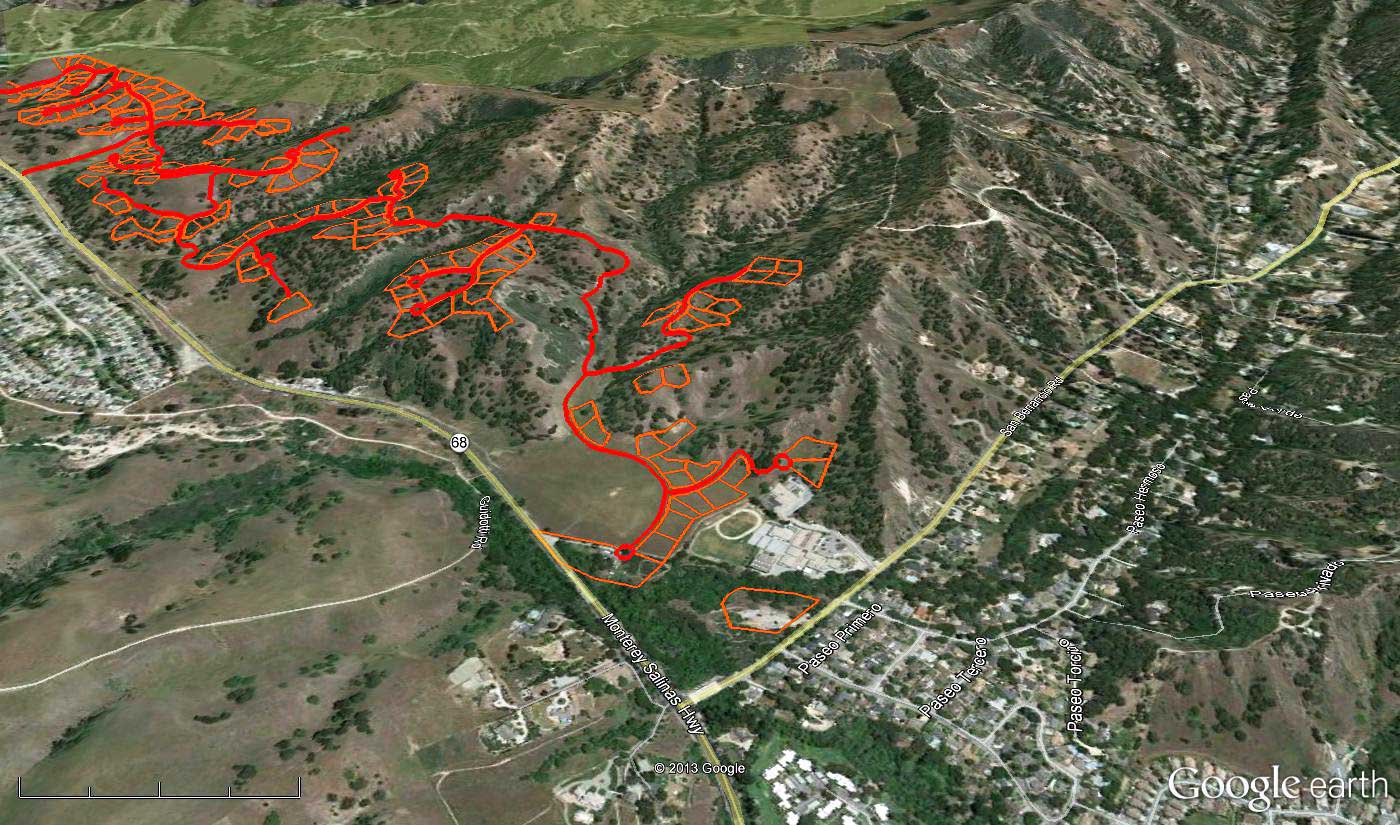 |
Aerial view above Proposed Winery looking south along Highway 68 |
Aerial view above the intersection of Highway 68 and San Benancio Road looking north east. |
 |
 |
Aerial view looking east above Toro Place Café |
Aerial view above Toro County Park looking east |
 |
 |
Aerial view above proposed Ferrini Ranch entry road off Highway 68 |
Aerial view above Toro Place Café looking south east |
Aerial view above Toro County Park entry showing proposed Ferrini Ranch access road through the park. |
Aerial view of proposed winery looking east toward River Road. |
LandWatch encourages the public to submit comments on project and DEIR by Friday, November 16, 2012 at 5 PM. After the comments are reviewed the Response to Comments will be issued with the Final EIR, which will be scheduled for certification by the County Board of Supervisors at a later date.
[Return to Ferrini Ranch Issues and Actions]
Posted 11.08.12
|
CONTACT 306 Capitol Street #101 PO Box 1876 Phone (831) 759-2824 Fax (831) 759-2825 |
|